Press release 2020-05-29 at 17:30

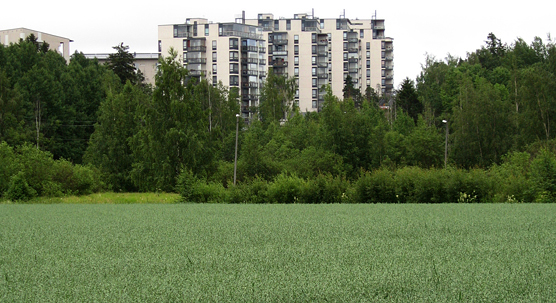
Green area in the inner urban area in Pihlajamäki in Helsinki. © Photo: Pirjo Ferin.
According to the urban-rural classification updated by the Finnish Environment Institute, more than 72 per cent of the Finnish population now reside in the urban areas of the country. The degree of urbanisation has increased more than two percentage points when compared to the classification based on the demographic data of the year 2010. The updated classification represents the situation of the year 2018. The regional classes with the most expanded surface areas are the rural areas close to urban areas and the peri-urban area. More than half of the country’s jobs are now located in the most densely populated inner urban area where more than two million of the country’s population is living and where the density of jobs is the greatest.
Cities covering five per cent of surface area
The increase of the degree of urbanisation is caused by the population growth and increased density in the cities as well as by the extension of the urban area. The inner urban area has extended to the previously outer urban area, while the outer urban area has further extended to the peri-urban area. The peri-urban area in turn has extended to areas that have previously been classified as rural. Despite their growth, the urban areas only cover approximately five per cent of the country’s entire surface area – the rest is considered rural area.
The growth of the most densely built inner urban area is caused by infill construction as the newly built areas are linked with the uniformly built area.
“In the metropolitan area, for example, infill construction has caused the more unified inner urban area to extend towards Espoonlahti in the west and towards Kerava in the northeast, according to the Finnish Environment Institute’s researcher Kimmo Nurmio.
More than half of the country’s jobs are now located in the inner urban area where more than two million of the country’s population is living. The population growth and the increase of jobs is mainly focused in the urban areas.
Extending zone of interaction between the urban and the rural
The regional classes with the most expanded surface areas are the rural areas close to urban areas and the peri-urban area. This is considered as an indication of the growth of the cities’ area of influence. The growth of the rural areas close to urban areas is mainly caused by the growth of the cities’ employment areas.
“This can be caused by the concentration of employment, the increase of remote work opportunities as well as the improvement of transport connections, for example”, Nurmio estimates.
The extension of the peri-urban areas is mainly caused by the fact that new agglomerations have linked with urban areas. Even though the area of this middle zone has grown, its population has slightly declined after a long, steady period; among other reasons, this is due to the fact that the area type has extended to other areas with declining populations.
The traditionally agricultural rural heartland areas form the regional class that has reduced the most in size. It has lost areas to both rural areas close to urban areas and to sparsely populated rural areas. On the other hand, the rural heartland areas have also extended to new regions in rural areas that were previously sparsely populated.
Population distribution according to the urban-rural classification (2018)
Classification system independent of municipality boundaries
In the urban-rural classification system, areas are divided in seven regional classes independent of municipality boundaries. The urban areas are divided in the inner urban area, outer urban area and peri-urban area. Rural areas consist of local centres in rural areas, rural areas close to urban areas, rural heartland areas and sparsely populated rural areas.
The classification system is based on national information regarding the population, labour force, commuting and construction as well as on data regarding road networks and land use, among others. The result is significantly more accurate and versatile compared to classification into urban and rural municipalities based on the municipality boundaries. The newly published regional classification has been updated according to the statistics from the year 2018. The previous classification represented the situation in the year 2010.
Classification available for download in a spatial data format
Both the updated and the previous regional classification system are available for download in an open spatial data format from the Finnish Environment Institute’s download services. A report summarising the updated situation and covering the changes compared to the previous classification has also been published.
The urban-rural classification update has been carried out by the Finnish Environment Institute (SYKE). The work was commissioned by the Ministry of Economic Affairs and Employment (MEAE) and Ministry of Agriculture and Forestry (MAF).
Spatial data
Report in Finnish
Web page
Additional information
- Researcher Kimmo Nurmio, Finnish Environment Institute SYKE, tel. 0295 251 466, email: firstname.lastname@ymparisto.fi
- Communications Specialist Matti Lindholm, Finnish Environment Institute SYKE, tel. 0295 251 380, email: firstname.lastname@ymparisto.fi